Boyd, Gregory A. Family Maps of Amite County, Mississippi. Deluxe. Norman, Oklahoma: Arphax Publishing Co., 2006.
This is the fourth of these map books that I have purchased. I love these books! They have led me to great family discoveries in the past. In these books land patent information is given and indexed by surname. I quickly found Edward Brown on two of the maps. On Map #10 he owned four sections along Robinson Creek. On Map #21 he owns two sections. All these land patents date to 10 November 1840. I also found William G Brown owning land adjoining one of Edward’s sections. This could be Edward’s nephew, son of his brother James G. Brown.
The discoveries did not end there. Mr. Boyd’s book notes that my ancestor purchased this land as part of an Act of Congress that authorized on 24 April 1820 “Cash Sale Entry 93 Stat. 566). An online search explained this act: The Cash Entry Act of April 24, 1820 (3 stat. 566) allowed the outright purchase of federal land. It reduced the minimum size of the tract from 160 to 80 acres. Additionally, the act required a down payment of $100 and reduced the price from $1.65 to $1.25 per acre.
To learn more Mr. Boyd directs readers to www.arphax.com , Arphax Publishing Company.
 |
| Arphax Publishing Click to enlarge |
 |
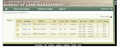
| Bureau of Land Management Click to enlarge |
 |
| Edward S Brown Search |
 |
| Details on Search for Edward S Brown |
Patent Image for Edward Stewart Brown
I was very happy to learn something about this ancestor because I had very little information about him. I did a second search at the Bureau of Land Management website inputting the information on the second map. Edward Stewart Brown had made a second investment in land on 1 June 1859. I thought this might be an error but looked carefully and saw the details & certificate.
Family records had shown that Edward died 7 May 1856. As far as I know he had five children, none of them named Edward. In 1860 his wife was a widow. I am going to see what else I can find to verify his death date. He did not have a long life but it looks like he made it past 50 after all.
Sources:
· 1840 US Census, MS, Amite; Roll 213, page 55, image 115; ancestry.com. E S Brown.
· 1845 & 1853 MS State and Territorial Census Collection, 1792 – 1866; microfilm V229.1; ancestry.com. Edward S Brown in Amite Co.
· 1850 US Census, MS, Amite Co; Roll M432-368. Line 30. E S Brown family.
· 1860 US Census, MS, Amite, Liberty; M653-577, National Archives. Mary Brown and children.
· Boyd, Gregory A. Family Maps of Amite County, Mississippi. Deluxe. Norman, Oklahoma: Arphax Publishing Co., 2006.
· Criminger, Adrianne Fortenberry. The Fortenberry Families of Southern Mississippi with Early Records Concerning the Faulkenberry/Fortenberry Families of the South. Easley, South Carolina: Southern Historical Press, Inc., 1984.


What great information. Mappy Monday could easily be Tuesday Tip too!
ReplyDelete